How Remote Collaboration is Reshaping Emergency Planning
- Richie Romero
- May 14
- 7 min read
Here’s where emergency planning breaks down: your team is training on a building that no longer exists—at least not in the version living in binders, PDFs, and memory. Renovations shift egress paths, storage creeps into corridors, and critical shutoffs get moved. Then an incident happens, and the “plan” becomes a guessing game.
TL;DR
Remote collaboration only works in emergencies when everyone shares the same spatial truth—an accurate, current 3D model of the facility.
Digital twins reduce coordination drag; Deloitte reported up to a 40% coordination-time reduction in organizations adopting digital twin approaches for complex planning.
For data centers and industrial sites, rehearsal quality directly impacts downtime exposure—Ponemon has cited data center outage costs in the thousands of dollars per minute.
Start by capturing one “high-consequence zone” (electrical rooms, loading docks, chemical storage) and run one repeatable scenario with multi-user walkthroughs.
Remote emergency planning isn’t a meeting problem. It’s a shared-reality problem.
Most teams treat remote emergency planning like a communications upgrade: more calls, more checklists, more “alignment.” That’s not the failure. The failure is that each stakeholder is visualizing a different facility.
When the safety officer references “Stairwell B,” facilities thinks of the original build, security thinks of the post-renovation access control layout, and the fire warden thinks of the last drill route. That mismatch delays decisions and creates conflicting instructions. That’s where incidents get messy.

Digital twins fix the root issue because they replace interpretation with geometry. A spatially accurate model becomes the single source of truth for evacuation routes, hazard zones, and staging points—especially when teams are distributed across shifts and locations.
In a public-sector context, Deloitte notes that digital twin approaches can reduce coordination time by as much as 40% in complex planning environments. That’s not a productivity win. It’s fewer chances to misunderstand each other under pressure. See: Deloitte on digital twins in government.
What most “remote training” gets wrong: it teaches procedures without teaching the building
Tabletops and slide-based drills teach policy. They don’t teach spatial decision-making—line of sight, choke points, door swing conflicts, equipment clearance, or the reality of moving people through a space.
That gap is expensive in high-availability environments. Ponemon’s research on data center outages has repeatedly put downtime costs in the thousands of dollars per minute, with substantial variance by environment and incident type. Even conservative assumptions turn “small” response delays into real financial exposure. Source: Ponemon Institute: Cost of Data Center Outages.
This is why immersive rehearsal matters. When teams can move through an accurate facility replica, they stop debating hypotheticals and start validating constraints: “Can a gurney clear this turn?” “Is this valve actually accessible?” “Where does the crowd bottleneck?” One blocked corridor you can’t see on a 2D plan becomes obvious in 3D.
Static plans don’t fail quietly. They fail all at once.
How 3D digital twins change emergency readiness in facilities, campuses, and industrial sites
Emergency planning improves when your model is photorealistic, measurable, and usable by multiple stakeholders at the same time. That’s the operational bar—not “cool visuals.”
Verge Visions builds a 3D Digital Twin & Immersive Simulation Training using Gaussian Splatting to create a spatially accurate 3D replica of a real facility. The point isn’t novelty. The point is decision confidence: teams stop arguing about what’s there and start deciding what to do.
Two platform capabilities change day-to-day readiness immediately:
Live Guided Tours enable multi-user walkthroughs where incident commanders, facilities, and security can navigate together, hand off control, and call out constraints in real time. This eliminates the “I’m not sure what you’re looking at” failure pattern that plagues screen-shared floor plans.
Pinned Notes for Collaboration let teams drop location-specific tasks directly into the environment—“replace this exit sign,” “clear this storage,” “verify shutoff labeling.” If the note isn’t tied to a place, it doesn’t get done.
This isn’t an emergency planning problem. It’s an accuracy problem.
A destabilizing truth: your last renovation probably made your emergency plan less reliable
Most facilities update policies faster than they update spatial documentation. After a renovation, the floor plan might be revised, but the drill routes, muster point assumptions, and utility shutoff references typically lag behind—sometimes by years.
That creates a dangerous illusion: leadership believes you’re “covered” because a plan exists, while responders inherit a plan that no longer matches the building. The more you invest in documentation without updating spatial truth, the more confident—and wrong—you become.
Confidence built on outdated geometry is a liability.
If you manage a data center, a manufacturing site, a hospital wing, or a multi-building campus, this mismatch shows up as slower decisions, conflicting instructions, and avoidable downtime. It also shows up in audit friction when you can’t prove readiness beyond a PDF.
Case scenario: a multi-building campus finds its “safe routes” weren’t safe
A common pattern we see: a multi-building corporate campus runs annual evacuation drills that “pass,” then discovers during a facilities walkthrough that a remodel turned a previously viable corridor into a storage overflow zone—narrowed clearance, new access control door, and a blind corner near a utility room.
On paper, nothing changed. In reality, the route degraded.
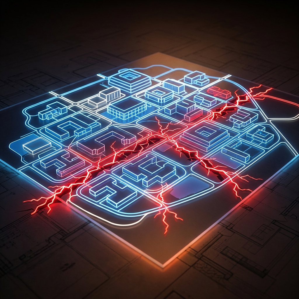
With a digital twin, that kind of failure becomes visible before it becomes consequential. Teams can validate routes in the model, annotate the exact obstruction point, and re-run the scenario with the updated constraint. That’s the difference between training theater and operational readiness.
For teams that also need incident-specific spatial prep, pair a digital twin with Critical Incident Mapping so first responders and facility managers can coordinate on exact dimensions, access points, and staging locations inside the same environment.
Implementation: a practical rollout plan that doesn’t stall in procurement
Remote collaboration succeeds when it’s introduced like an operational system, not a one-off “innovation project.” Use a narrow-first rollout with measurable outputs.
Pick one high-consequence zone.Choose an area where mistakes cost time and money: electrical rooms, loading docks, chemical storage, generator yards, or a data hall perimeter. One zone is enough to prove value.
Capture a photorealistic baseline.Use a spatially accurate model so measurements and navigation match reality. This is where a true digital twin outperforms stitched photo tours.
Tag what matters for response.Use Safety Object Identification to mark AEDs, fire suppression controls, alarms, utility shutoffs, and hazmat zones so responders aren’t hunting for assets during a walkthrough.
Run one repeatable scenario.Start with a single scenario (fire, flood, active threat, chemical spill) and run it twice: once as-is, then again after improvements are pinned and verified.
Measure engagement and gaps.Use Real-Time Analytics to see where teams spend time, which hotspots get used, and which zones are ignored. Ignored zones become your next training target.
Miss step three, and your “training” becomes a guided tour.
Keeping the model trustworthy: the maintenance step most teams skip
What most organizations get wrong is treating a 3D model as a deliverable instead of a living record. The moment you reconfigure a space, your readiness decays unless the model updates with it.
That’s why ongoing facility accuracy matters as much as the initial capture. Verge Visions supports this with Digital Twin Solutions for Facilities, Data Centers & Industrial Sites, designed to stay current after renovations and operational changes.
For teams comparing platforms, it’s also worth reviewing Matterport Alternatives to understand where common tools fall short for operational accuracy and multi-department use.
Expert perspective: why precision collaboration is changing emergency readiness
Emergency management standards increasingly emphasize interoperability, repeatability, and accuracy. Digital twin research continues to mature across government and critical infrastructure use cases, including training and planning applications.
As NIST notes in its published work on digital twin technologies for emergency management, the value comes from using accurate digital representations to improve planning and response decisions. Reference: NIST: Digital Twin Technologies for Emergency Management.
When teams can train inside a faithful replica of the real facility, they stop debating assumptions and start validating constraints. — Naomi Keller, Verge Visions
Where this goes next: from planning to always-on readiness
The future of emergency planning is embedded guidance, not binders. Interactive Hotspots let you place protocols, videos, and documentation exactly where decisions happen—at the panel, the corridor junction, the stairwell landing. That beats searching a shared drive during an incident.
Your showroom can be open 24/7 from anywhere, but for safety teams the stakes are higher: your facility needs to be navigable 24/7 in a way that’s accurate. As close as being there gets only matters when “there” is correct.
If you want to see how facilities like yours are using immersive environments to reduce coordination drag and tighten response readiness, start by reviewing Verge Visions’ work in Architecture and Design and our broader Blog, then take the decisive next step: benchmark your emergency readiness workflow against what leading facilities teams are doing with digital twins.
FAQ
What is remote collaboration in emergency planning?
Remote collaboration in emergency planning means safety, facilities, and response stakeholders can coordinate, rehearse, and document decisions without being on site—using shared tools like a spatially accurate 3D digital twin instead of disconnected PDFs and calls.
How does emergency response simulation improve training outcomes?
Simulation improves training because teams practice decisions in the real layout—routes, choke points, access-controlled doors, and asset locations—rather than memorizing generic procedures. Repeatable runs also make improvements measurable from one session to the next.
What’s the difference between a 3D virtual tour and a 3D digital twin for emergency planning?
A 3D virtual tour is primarily visual and designed for walkthrough experiences. A 3D digital twin is built for spatial accuracy and operational use—so teams can trust dimensions, validate routes, and coordinate decisions across departments.
How do you keep a digital twin accurate after renovations?
Treat the model as a living facility record: update it after reconfigurations, tenant improvements, or major equipment moves. Ongoing facility-focused digital twin programs prevent “readiness decay” caused by outdated geometry.
About the Author
Naomi Keller is a strategist in content and visual media at Verge Visions, focused on practical adoption of photorealistic 3D capture, digital twins, and immersive training. She helps facilities, real estate, and experience-driven brands turn complex spaces into measurable, usable digital environments—especially where accuracy and coordination determine outcomes.
Disclaimer: The statements and products discussed in this article have not been evaluated by the Food and Drug Administration (FDA). This content is for informational and educational purposes only and is not intended to diagnose, treat, cure, or prevent any disease. Always consult with a qualified healthcare provider before starting any new supplement, product, or wellness routine.